The County-Data Hack That Finds Underpriced Parcels
Out-research bigger buyers by combining assessor data, tax delinquencies, GIS overlays, and simple math that spots value before the listing ever hits the MLS.
Introduction
The County-Data Hack That Finds Underpriced Parcels is a repeatable workflow that mines public records to surface sellers who are motivated, parcels with hidden utility, and sub-markets the retail crowd hasn’t mapped yet. You’ll use plain CSVs, free GIS viewers, and a lightweight scoring sheet—no expensive tools required.
Compliance: Verify zoning/use, access, flood, wetlands, HOA/POA, and local solicitation rules. This is educational content—not legal advice or a guarantee of profits.
Expanded Table of Contents
- 1) Why “The County-Data Hack That Finds Underpriced Parcels” Works
- 2) The Data Stack: What to Pull, Where to Find It
- 3) Filters That Predict Motivation & Mispricing
- 4) Scoring Model: Utility × Motivation × Liquidity
- 5) GIS Layers: Access, Slope, Flood, and Services
- 6) Pricing Math: Land-Comp Triangulation
- 7) Outreach: Mail, SMS (where allowed), and Call Cadence
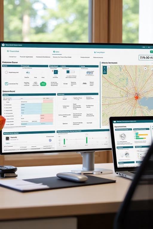
- 8) KPIs & Dashboard: What to Track Weekly
- 9) 30–60–90 Day Execution Plan
- 10) Troubleshooting: False Positives & Dead Parcels
- 11) Templates: Script Snippets & Offer Language
- 12) 25 Frequently Asked Questions
- 13) 25 Extra Keywords
1) Why “The County-Data Hack That Finds Underpriced Parcels” Works
- Asymmetry: County systems are messy; few buyers normalize them. You will.
- Lead-time: You see distress (tax, code, probate) months before listings.
- Precision: GIS layers expose access/utilities so you avoid “cheap for a reason.”
2) The Data Stack: What to Pull, Where to Find It
| Dataset | Fields to Keep | Notes |
|---|---|---|
| Assessor Roll | APN, Owner, Situs, Mailing, Acres, Land Value, Last Sale, Assessed | Export CSV; some counties require a request |
| Delinquent Tax List | APN, Years Owed, Amount, Redemption Status | High-motivation signal; verify redemption timelines |
| GIS Parcels | Geometry, Zoning, Road Class, Utilities | Download shapefile/GeoJSON or map service |
| Recorder Deeds | Transfer dates, docs, probate hints | Heirs & out-of-state owners pop here |
| Code/Violation Logs | Trash, weeds, unsafe structure | Pairs well with tax delinquency |
3) Filters That Predict Motivation & Mispricing
- Absentee + Long Tenure: Mailing state ≠ situs state AND last sale > 10 years.
- Tax Delinquent: Owed ≥ 2 years OR amount owed > 2% of assessed value.
- Odd Lot / Orphan Parcels: Acreage below area median by 1.5σ, but with road touch.
- Assessed/Acres Outliers: Land value per acre < 50% of tract median.
- Estate/Heir Signals: Recent transfer to trust/estate; mailing to attorney.
Stack two motivation filters + one utility filter (access/utilities) for the strongest hits.
4) Scoring Model: Utility × Motivation × Liquidity
| Factor | Signals | Score (0–5) |
|---|---|---|
| Utility | Road access, slope < 15%, power/water nearby | 0–5 |
| Motivation | Tax delinquent, absentee, estate | 0–5 |
| Liquidity | DOM comps, cash buyer density, HOA-free | 0–5 |
DealScore = 0.5*Utility + 0.35*Motivation + 0.15*Liquidity
Target: DealScore ≥ 3.4
5) GIS Layers: Access, Slope, Flood, and Services
- Access: Road-class layer + parcel boundary = confirm ingress/egress.
- Slope: 0–15% is build-friendly; 15–30% needs engineering.
- Flood/Wetlands: Exclude Zone A/AE where building is constrained.
- Utilities: Distance to nearest meter/pole/main; note cost-to-extend.
- Zoning: Allowed uses, min frontage, min lot size—screen early.
6) Pricing Math: Land-Comp Triangulation
- Raw $/acre (sold): Median of last 6–12 months within 10–20 miles, same zoning.
- Adjust for utility: Road + power + water present → up to +25%; missing utilities → −20–40%.
- Offer bands: Aim for 35–55% of adjusted retail if quick flip; 55–70% if planning entitlement lift.
AdjustedRetail = CompMedian * UtilityMultiplier
Offer = AdjustedRetail * TargetDiscount
Example: $12,000/ac * 0.85 utilities * 0.45 = $4,590/ac offer
7) Outreach: Mail, SMS (where allowed), and Call Cadence
- Week 1: Neutral letter + QR to property page, soft ask: “Open to an offer?”
- Week 2: Call attempt ×2; voicemail with APN + quick benefit (no pressure).
- Week 3: Postcard: “We confirm access & pay closing costs.”
- Week 4: Follow-up letter with range: “$X–$Y pending drive-by.”
Check state/federal rules before SMS/robocalls. Respect do-not-call and opt-out requests.
8) KPIs & Dashboard: What to Track Weekly
Records Processed
≥ 2,500/wk
High-Score Parcels
≥ 60/wk
Conversations
≥ 15–25/wk
Offers Sent
≥ 8–15/wk
Contracts
≥ 1–3/wk (steady state)
Segment results by county. Double down where Offer→Accept is highest.
9) 30–60–90 Day Execution Plan
Days 1–30 (Foundation)
- Pull assessor + delinquent lists for 2–3 counties; normalize fields.
- Build scoring sheet; add GIS checks for top 20%.
- Launch Week 1 letters; prepare call scripts.
Days 31–60 (Momentum)
- Expand to 4–6 counties; systematize offer math.
- Add postcard follow-ups; test range pricing vs firm offers.
- Create a simple parcel page template for QR traffic.
Days 61–90 (Scale)
- Automate imports; weekly refresh delinquent and code logs.
- Introduce buyer list for quick assignments; track days-to-dispo.
- Quarterly audit: remove flood/wetlands time-wasters from target zones.
10) Troubleshooting: False Positives & Dead Parcels
| Symptom | Root Cause | Fix |
|---|---|---|
| Great price, no buyers | Poor access or wetlands | Require road class + flood screen before offer |
| Many conversations, few contracts | Offer band too tight | Widen to 45–55% for first touches |
| Returned mail | Outdated owner address | Cross-check recorder + skip trace ethically |
| Title surprises | Liens/encumbrances | Prelim title check on top 10% before formal offer |
11) Templates: Script Snippets & Offer Language
Opening Call
“Hi, is this {{Owner}}? I’m calling about APN {{APN}} near {{Road}}.
We buy small acreage in the area. Would you consider an offer if we cover closing?”
Mail Line (Range)
“Based on nearby sales and access, we can likely offer between ${{Low}}–${{High}} pending a quick drive-by.”Counter (When High)
“If utilities are closer than mapped, we can move toward the top of the range
and close in {{Days}} with no contingencies after clear title.”
12) 25 Frequently Asked Questions
1) What is “The County-Data Hack That Finds Underpriced Parcels”?
A workflow that scores public records to prioritize land deals others miss.
2) Which counties should I start with?
Choose areas with active land buyers, clear GIS portals, and decent transaction volume.
3) Is assessor value reliable?
It’s a starting point; adjust with real comps and utility checks.
4) How often do I refresh lists?
Assessor quarterly; delinquent monthly; code logs monthly.
5) What acreage range works best?
Common sweet spots: 1–20 acres near growth corridors.
6) What about APNs with no road?
Flag as low utility unless easements exist. Verify access before offers.
7) How do I estimate power/water cost?
Get per-foot extension ballparks from local utilities; add to your underwriting.
8) Do HOAs kill deals?
They can limit use. Read CCRs early; many investors prefer HOA-free.
9) Can I wholesale these parcels?
Yes, where permitted—check assignment rules and disclosure requirements.
10) Best comp radius?
Start 10–20 miles; match zoning/terrain and adjust for utilities.
11) How do I handle wetlands/flood quickly?
Overlay FEMA/wetlands layers; exclude Zone A/AE for beginner flips.
12) What if owner is deceased?
Look for probate filings/trusts; consult a local attorney for procedure.
13) Do I need a GIS subscription?
Not necessarily—many counties have free viewers; you can also use free desktop tools.
14) Should I price by acre or by parcel?
Price by acre, then sanity-check total vs demand and utility.
15) What mail format performs?
Plain envelope + short letter + QR performs well; test postcards as follow-up.
16) Can I SMS owners?
Only if lawful in your jurisdiction with proper consent/opt-out handling.
17) How fast should I close?
Have a title company ready; quick-close is a competitive edge.
18) What’s a good offer acceptance rate?
8–20% depending on your list quality and pricing band.
19) Do I need a survey?
Obtain when boundaries are unclear or for splits; otherwise use county maps cautiously.
20) Can I split parcels?
Check subdivision rules, frontage minimums, and timeline before underwriting the lift.
21) How do I build a buyers list?
Market on land marketplaces, local Facebook groups, and to builders; track repeat buyers.
22) What kills beginner deals?
No legal access, flood/wetlands, impossible utilities, or HOA restrictions.
23) Should I use range offers?
Ranges increase callbacks; finalize after a quick drive-by and utility check.
24) How do I manage data?
Use a simple CRM or spreadsheet with APN as the key; version your lists.
25) First step today?
Pull one county’s assessor + tax list, run the filters, score, and mail the top 50.
13) 25 Extra Keywords
- The County-Data Hack That Finds Underpriced Parcels
- assessor roll land deals
- delinquent tax land leads
- apn research workflow
- gis parcel overlay guide
- rural land comps method
- land utility multiplier
- parcel access verification
- flood zone screening
- wetlands map checks
- absentee owner land list
- estate probate land lead
- orphan lot opportunity
- land buyers list building
- title issues land flips
- zoning code shortcuts
- county csv normalization
- land offer band formula
- qr letter for land owners
- drive-by verification steps
- rural utilities extension cost
- parcel scoring model
- land dispo pipeline
- apn to crm mapping
- 2025 land flipping playbook


